There are many opportunities in Fillmore County to explore the local landscape and take in some recreational conservation activities. From hiking, caves, biking, walks, rivers, creeks, bird and nature watching, you will find something to get out and explore.
Explores some of these trails and activities.
Lost Creek Hiking Trail – Chatfield, MN
There are many forestry practices and natural features along the Lost Creek Hiking Trail. There
are signs along the trail pointing out these features. See below for more information.
Maynard Underbakke Trail – Carimona, MN
Get to know this 2-mile, loop trail near Carimona, Minnesota. Generally considered an easy route, it takes an average of 55 min to complete. This trail is great for camping, hiking, and horseback riding, and it’s unlikely you’ll encounter many other people while exploring. The trail is marked by brown signs on highway 16 between Preston and the turn off for Wykoff. Learn more.
Isinours Trail – Preston, MN
Isinours Management Unit is a 188-acre tract of land located about three miles north of Preston near the South Branch of the Root River. This unit is an interpretive trail exploring forest management techniques being studied and demonstrated. Download the Isinours Management Unit map to follow along.
Root River State Trail
The paved Root River State Trail meanders 42 miles alongside the Root River from Fountain to Houston. Constructed on an abandoned railroad, the trail is generally level and wheelchair accessible except for a steep half-mile segment between Vinegar Ridge and Houston that may be challenging for some visitors. Learn more.
Harmony-Preston Valley State Trail
The paved Harmony-Preston Valley State Trail is a beautiful 18-mile multiple use trail that connects the communities of Harmony and Preston with the Root River State Trail in southeastern Minnesota’s Blufflands region. In the summer the trail is used mainly for hiking, biking and in-line skating. The trail is groomed for cross-country skiing in winter. Learn more.
Root River Water Trail
The Root River represents the timeless scenic and historic qualities characteristic of southeastern Minnesota. The river has gentle to moderate flow with a few riffles, although water level can vary substantially with rainfall. Learn more.
Niagara Cave – Harmony, MN
Visit this family owned and operated cave, which has been rated among the best in the nation, to witness nature’s power and beauty underground. In Niagara Cave you will have the opportunity to see natural canyon-like passageways sculpted by water from an underground stream. Learn more.
Mystery Cave – Preston, MN
Mystery Cave is the longest cave in Minnesota, with over 13 miles of underground passages! Each guided tour takes you underground through different areas, and showcases scenic pools and a variety of cave formations. Learn more.
Wildlife Management Areas (WMA) – Nearest town indicated.
- Beaver Creek WMA – Ostrander
- Cherry Grove WMA – Cherry Grove
- Choice WMA – Choice
- Chosen Valley WMA – Chatfield
- Dr. Johan C. Hvoslef WMA – Amherst
- Goethite WMA – Spring Valley
- Nosek WMA – Etna
- Rush Creek Woods WMA – Rushford
- Seven Springs WMA – Wykoff
- Spring Valley WMA – Spring Valley
- Upper Iowa River WMA – Le Roy
- William Pease WMA – Chatfield
- Yucatan WMA – Houston
Lost Creek Hiking Trail
“What’s lost about Lost Creek?”
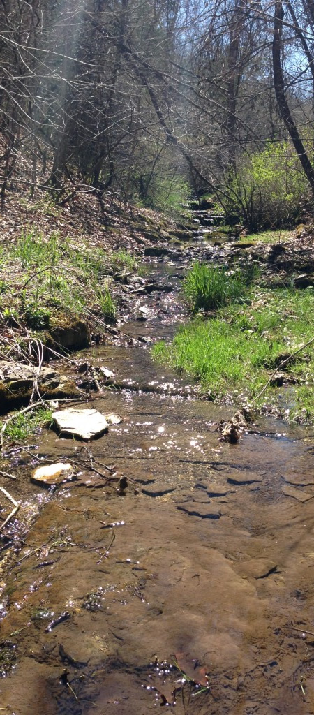
While many nearby streams supported by spring-fed cold water are renowned for their trout fishing, there are no such springs along this section of Lost Creek. The water here, rather than emerging disappears into the ground. In particularly dry years the stream has reportedly disappeared into the karst landscape, and hence was “lost.”
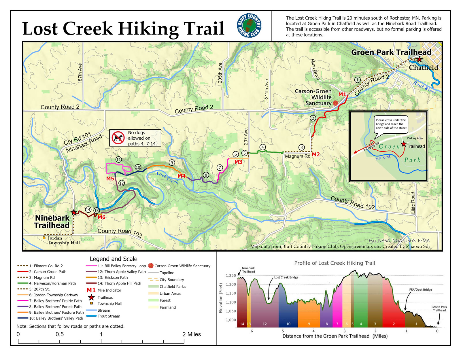
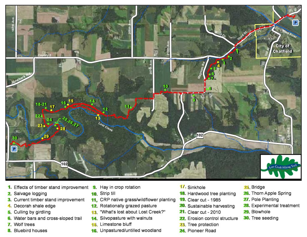
There are many forestry practices and natural features along the Lost Creek Hiking Trail.
There are signs along the trail pointing out these features, and this brochure will give you information about each one.
Green signs indicate practices and yellow signs indicate features.
This forestry interpretative information is provided by the
Fillmore Soil and Water Conservation District and the
Bluff Country Hiking Club.
For futher information on each of the practices and features highlighted in the brochure, click on the topics listed below.
- Blue Bird Houses
- Clear Cuts
- Cottonwood and Willow Pole Planting
- Culling by Girdling
- Decorah Shale Edge
- Direct Tree Seeding
- Erosion Control Steps
- Erosion Control Structure
- Experimental Treatment to Control Reed Canary Grass
- Hardwood Tree Seedling Planting
- Hay in Crop Rotations
- Karst Landscape
- Rotational Grazing
- Salvage Logging
- Silvopasture with Walnuts
- Strip Tillage
- Sustainable Harvesting
- Swing-Away Bridge
- Timber Stand Improvement
- Tree Protection – Tree Tubes and Bud Capping
- Water Bars & Cross Sloped Trail
- Wolf Trees Left for Habitat
Everyday Conservation Opportunities
Urban Conservation
Recreational Conservation Activities


